UN
9 Coleman Drive
£ 410,000
Description
We don't have a Description for this property.
- Bedrooms
- 5
- Bathrooms
- 0


Leaflet © OpenStreetMap contributors
The heatmap indicates the level of crime in the area. The color of the heatmap indicates the crime severity and recency.
Metrics Year-on-Year
- Average area value
- 225,569.00 £Increased by 14.06 %
- Average area rental value
- 780.00 £/moIncreased by 84.40 %
- Est rental Yield
- 4.15 %Increased by 61.48 %
- Crime Rate
- 10.00 %Unchanged by 0.00 %
from 197,762.00 £
from 423.00 £/mo
from 2.57 %
from 10.00 %
Nearby Schools
| Name | Type | Ofsted | Distance |
|---|---|---|---|
| Central Lancaster High School | Academy Converter | 1.59 KM | |
| Lancaster Christ Church Church Of England Primary School | Voluntary Aided School | Good | 1.60 KM |
| Castle View Primary | Academy Sponsor Led | 1.99 KM | |
| Firbank Children'S Centre | Children's Centre | 2.15 KM | |
| Lancaster Royal Grammar School | Academy Converter | 2.35 KM |
Images
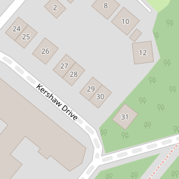
Nearby Streets
| Name | Average Price | Average Sqft | Distance |
|---|---|---|---|
| Quernmore Road | £ 155,000 | 0 | 0.00 KM |
| Stone Row Head | £ 0 | 0 | 0.00 KM |
| Grimeshaw Lane | £ 0 | 0 | 0.00 KM |
Nearby Transport
| Name | NLC | TLC | Distance |
|---|---|---|---|
| Lancaster | 2685 | LAN | 4.24 KM |
| Bare Lane | 2690 | BAR | 7.78 KM |
| Carnforth | 2640 | CNF | 8.79 KM |
Nearby Listings
| Address | Price | Type | Score | Distance |
|---|---|---|---|---|
| Coleman Drive, Lancaster, Lancashire, LA1 | £ 460,000 | BUY | 7 / 10 | 0.00 KM |
| Coleman Drive, Lancaster | £ 300,000 | BUY | Unknown | 0.03 KM |
| Coleman Drive, Lancaster | £ 460,000 | BUY | 7 / 10 | 0.07 KM |
| Coleman Drive, Lancaster, Lancashire, LA1 3FQ | £ 460,000 | BUY | 7 / 10 | 0.15 KM |
| Kershaw Drive, Lancaster | £ 200,000 | BUY | 5 / 10 | 0.18 KM |
Nearby Properties
| Address | Price | Distance |
|---|---|---|
| 22 Coleman Drive | £ 260,000 | 0.00 KM |
| 30 Coleman Drive | £ 196,950 | 0.00 KM |
| 9 Coleman Drive | £ 410,000 | 0.00 KM |
| 40 Coleman Drive | £ 265,000 | 0.00 KM |
| 6 Woodlands Close | £ 420,000 | 0.22 KM |